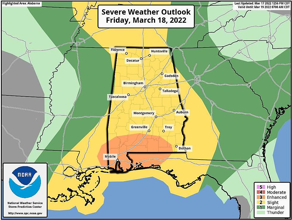
Severe Weather Friday: Central Alabama Upgraded to Slight Risk
The Townsquare Media Tuscaloosa Weather Center is keeping a close watch on a system that will move across West and Central Alabama on Friday, March 18, 2022. This is a large complex thunderstorm weather system.
New Severe Weather Information
The National Weather Service in Birmingham has issued updated information in regards to the possible severe weather threat. They have upgraded all of Central Alabama to a slight risk area along with adjusting the timeframe.
What You Need to Know
In the early part of Friday there will be a “low-end risk for severe weather associated with this initial surge of storms,” said the National Weather Service in Birmingham. Also, the NWS noted that “additional thunderstorms may develop along and just ahead of the cold front as it moves east. There is a conditional threat that these secondary storms may also carry a risk of severe weather which will include the possibility of a few tornadoes.”
Highlights
Where:
All of Central Alabama.
When:
Friday morning through the evening (6 AM - 10 PM).
Threats:
Quarter size hail.
Damaging winds up to 60 mph.
Tornadoes (mainly late morning through the early evening).
Localized flash flooding.
James Spann, ABC 33/40, and Townsquare Media Tuscaloosa Chief Meteorologist said that the “Storm Prediction Center (SPC) increases severe weather threat levels for Alabama tomorrow. One round of storms will come during the morning hours followed by a second-round later in the day, which could bring large hail, damaging winds, and a few tornadoes.”
(Source) Click here to follow the Facebook Page for James Spann. For more from the National Weather Service Birmingham, click here.
Most Shocking Crime Stories of 2021
All Homicides in Tuscaloosa County in 2021
Top Stories from the Tuscaloosa Thread (3/7 - 3/13)
More From Alt 101.7


