Saturday Storm Update in the Gulf
Storm coverage in the Caribbean continues Saturday as the National Wether Service prepares the southeast for multiple ongoing storms in the next week.
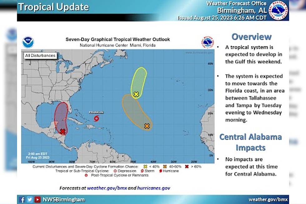
With models for Hurricane Franklin currently showing the storm tracking up the Atlantic coast, the NWS is now telling those in the Gulf to move their attention to a disturbance currently near Mexico's Yucatan Peninsula and the island of Cuba.

What We Know
If models continue to progress as they are at the moment, this storm is expected to make landfall in Florida, somewhere between Tampa and Tallahassee.
The NWS currently anticipates this system to reach land as early as Tuesday evening and continue northeast, back towards the Atlantic. Our coverage area in West Alabama is not expected to be impacted by the disturbance at this time, the NWS reports.
Continue to follow the coverage of this system and others as updates from the NWS in Birmingham are available.