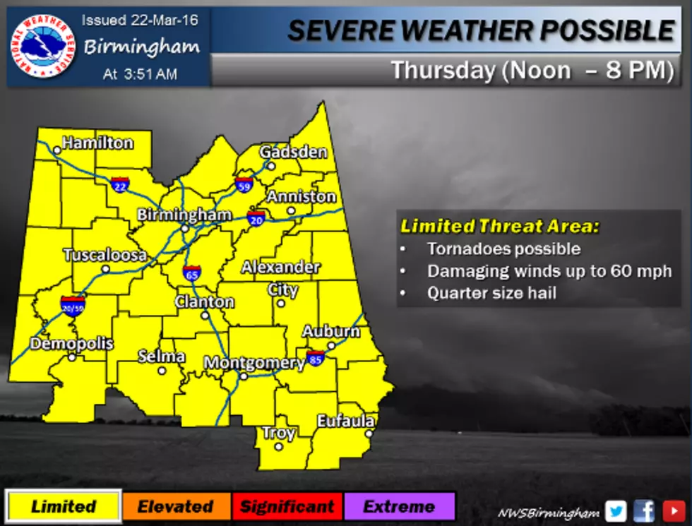
Thursday's forecast calls for thunderstorms, some of which could be severe. Tornadoes are possible as well as damaging winds of up to 60 MPH and quarter size hail.
The National Weather Service in Birmingham has issued a Severe Thunderstorm Watch in effect until 6 p.m. tonight; most of our listening area also remains under a Flash Flood Watch until 6 a.m. tomorrow morning.
Severe thunderstorms could impact West Alabama as early as 8pm tomorrow night according to the latest forecast from the National Weather Service in Birmingham.
The National Weather Service in Birmingham's forecast calls for severe storms this weekend, and it looks as if the best chance of severe weather will be in areas west of I-65.
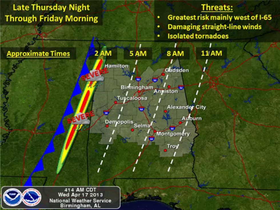
Severe storms are forecast to impact West Alabama late tonight and early tomorrow morning. Storms are projected to impact our listening area between 11pm and 6am. This line of storms is expected to bring damaging winds and isolated tornadoes, and our area currently is at the highest risk for this severe weather event...
The National Weather Service in Birmingham predicts severe storms by the end of the week. The latest forecast is as follows: "Severe weather, including the threat of damaging straight-line winds and isolated tornadoes, is possible late Thursday night through Friday morning...