Heads Up About Possible Severe Weather in Alabama Early Next Week
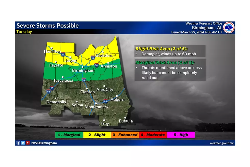
On Tuesday, a cold front is expected to sweep through the region, bringing the possibility of strong to severe storms to the northern parts of Central Alabama. Currently, this could impact some portions of the Townsquare Media coverage area.
James Spann, ABC 33/40, and Townsquare Media Tuscaloosa Chief Meteorologist, said, “The high Tuesday will be close to 80, and the air will be unstable, which is favorable for severe thunderstorms. But the kinematic fields remain in question; the better forcing will most likely be north of the state with somewhat unidirectional wind profiles.”

The timing of the cold front passage is still uncertain, resulting in a broad timeframe of Tuesday and Tuesday evening.
According to the National Weather Service in Birmingham, the current threat is damaging winds up to 60 mph. In addition, the rain could bring up to ½ inches to South Alabama, while the northern half of the station could see ½ to 1 inch.
The Townsquare Media Weather Center will continue to monitor this incoming active weather system and provide necessary updates.
Amazing and Intriguing Weather Folklore
Signs of a Bad Winter According to Weather Folklore
Gallery Credit: Mary K
Clouds: Artwork In The Sky
Sunrises from Around the World
KEEP READING: Get answers to 51 of the most frequently asked weather questions...
LOOK: The most extreme temperatures in the history of every state
Gallery Credit: Anuradha Varanasi
LOOK: The most expensive weather and climate disasters in recent decades
Gallery Credit: KATELYN LEBOFF
