National Weather Service Issues Flash Flood Watch for Tuscaloosa, Alabama
The National Weather Service in Birmingham has issued a Flash Flood Watch in effect for much of West Alabama.

Get our free mobile app
The text of the watch is as follows:
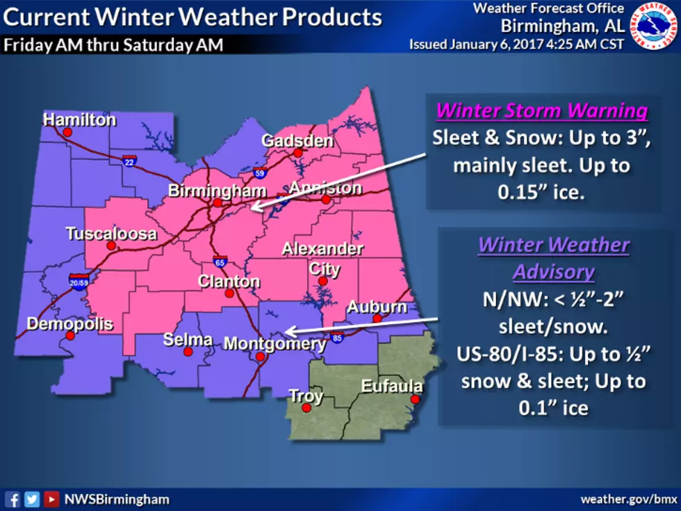
...FLASH FLOOD WATCH IN EFFECT THROUGH THIS EVENING...

The National Weather Service in Birmingham has issued a

* Flash Flood Watch for portions of central Alabama, east central
  Alabama, northeast Alabama and west central Alabama, including the
  following areas, in central Alabama, Bibb, Blount, Jefferson,
  Shelby, St. Clair, Talladega and Walker. In east central Alabama,
  Calhoun, Clay, Cleburne and Randolph. In northeast Alabama,
  Cherokee and Etowah. In west central Alabama, Tuscaloosa.

* Through this evening.

* Expected heavy rainfall across the watch area may result in
  localized flash flooding, especially in urban, low-lying and poor
  drainage areas.

PRECAUTIONARY/PREPAREDNESS ACTIONS...

You should monitor later forecasts and be prepared to take action
should Flash Flood Warnings be issued.
Townsquare Media Tuscaloosa's Operation Storm Watch is brought to you by Safe-T Shelter. Visit their website here to see their selection of residential and commercial safe rooms and storm shelters. To contact a Safe-T Shelter representative, click here to visit their Facebook page.
Check out the latest radar models here:
If a tornado warning is issued in our area, Townsquare Media Tuscaloosa Operation Storm Watch will provide you with live and local team coverage, including wall-to-wall weather with James Spann.
To view the latest weather updates and information, click here.
TIPS: Here’s how you can prepare for power outages
KEEP READING: What to do after a tornado strikes
KEEP READING: Get answers to 51 of the most frequently asked weather questions...
More From Alt 101.7