![Severe Storms Possible in Portions of West Alabama Tonight [VIDEO]](http://townsquare.media/site/530/files/2016/12/NWS-Monday-5-December.png?w=980&q=75)
Severe Storms Possible in Portions of West Alabama Tonight [VIDEO]
Another round of storms is expected to move across Alabama later tonight, and there is a chance that some of these storms could be severe.
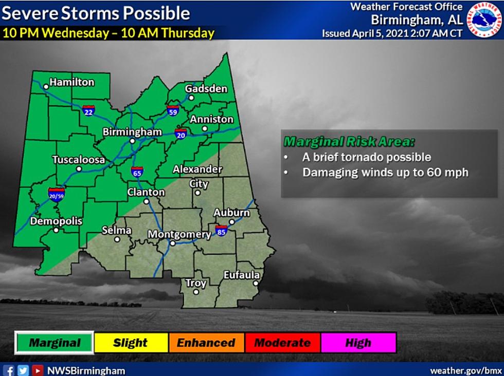
The National Weather Service in Birmingham's current forecast shows that the greatest threat for severe weather will be in the southern portion of the state. The forecast graph above shows portions of our listening area--Sumter, Greene, Hale, Perry, Marengo, Bibb, Perry, and Chilton Counties-- placed in a "limited" threat area. These counties could see storms capable of producing tornadoes and damaging winds of up to 60 MPH.
Storms are possible in Tuscaloosa as well; however, the latest forecast suggests that storms in the northern portion of the state should be under severe limits.
Get a more in-depth look at the severe weather threat by checking out the latest Weather Xtreme video from ABC 33/40 Chief Meteorologist James Spann below.
More From Alt 101.7